Trusted by
Trusted by





Benefits
Geospatial Advantage
Unlock the potential of location intelligence to propel your business forward
Informed Decisions
Confidently make strategic choices with comprehensive spatial data analysis
Efficient Planning
Simplify planning processes through data-backed insights
Optimized Operations
Streamline workflows through insightful geospatial visualizations
Data-led Success
Transform your organization with fact-based outcomes and resource allocation
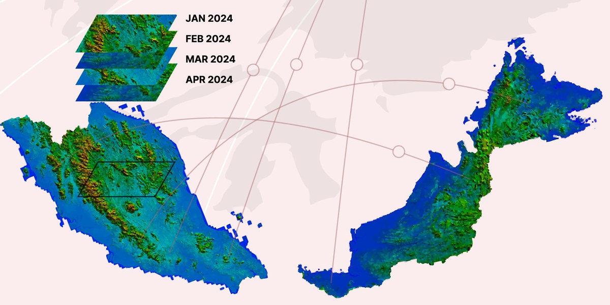
Earth Observation data discovery and acquisition
Data Discovery & Acquisition
We scout a collection of optical and SAR archive data and we can task the satellite to obtain the latest data.
Comprehensive earth observation data coverage
On-demand satellite tasking
Versatile imaging options
Earth Observation data monitoring and analysis
Data Monitoring & Analysis
From request to insightful analysis in three simple steps.
Easily provide your data requirements through our dedicated account manager.
Receive a detailed quote and project plan tailored to your needs.
Get high-resolution data and comprehensive reports for informed decision-making.
Earth Observation Applications
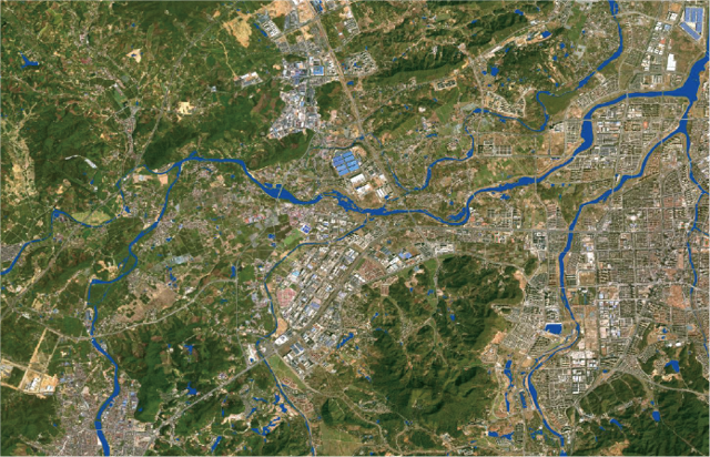
Water Body Monitoring
Utilizing optical data and AI, our water body monitoring service extracts detailed information about rivers, lakes, and ponds.
Best for
Water resource management, environmental protection, and disaster prevention.
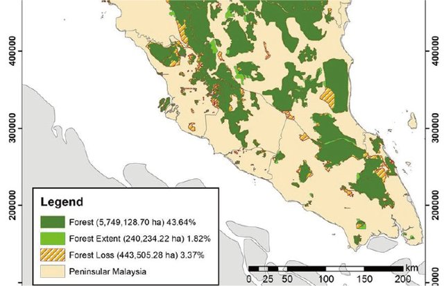
Forest Change Detection
Monitor forest changes with high accuracy using temporal satellite data. Get insights on spatial distribution, types of changes and affected areas.
Best for
Forestry, environment protection, and urban management departments.
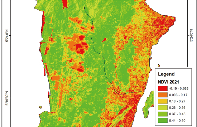
Vegetation Coverage Product
Estimate regional vegetation coverage using remote sensing images. Analyze vegetation density and growth for effective land management.
Best for
Natural resources and forestry departments.
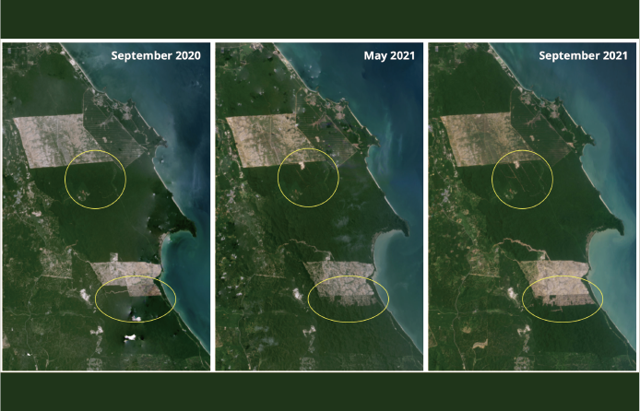
Nature Surveillance
Track changes in human activities within nature reserves to detect and address illegal actions promptly.
Best for
Urban management and environment protection departments.
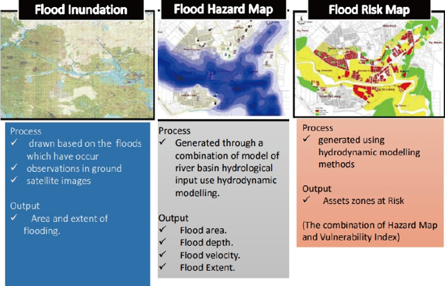
Flood Monitoring
Extract water body information before and after disaster using SAR/ optical images to assess flood impacts accurately.
Best for
Emergency management, meteorological and agriculture departments.
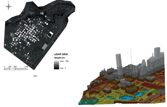
Building Contour Extraction
Derive detailed urban building contour information from high-resolution remote sensing images for digital twin applications.
Best for
Ideal for construction, emergency, and urban management departments.
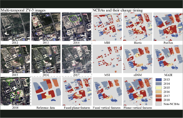
Building Change Detection
Monitor changes in urban buildings using multi-temporal high-resolution remote sensing image for proactive urban management.
Best for
Construction, urban management, and emergency departments.
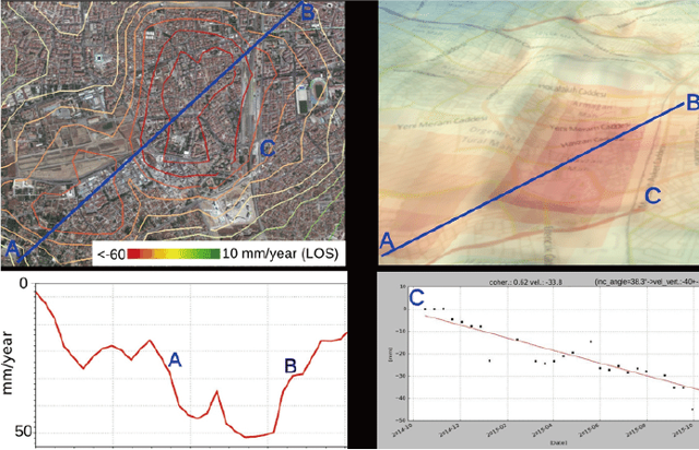
Infrastructure Subsidence Monitoring
Assess urban infrastructure deformation using SAR images to manage risks and ensure safety.
Best for
Construction and emergency management departments.
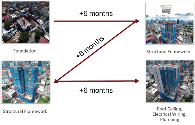
Construction Progress Monitoring
Monitor construction progress with optical images to manage project timelines effectively.
Best for
Ideal for construction and urban management departments.
Data Catalog
Geospatial Intelligence
Experience advanced mapping and analytics brought to life

We Simplify Earth Observation Data Discovery and Acquisition
We scout a collection of optical and SAR archive data and we can task the satellites to obtain the latest data.
We Simplify Earth Observation Data Monitoring and Analysis
We scout a collection of optical and SAR archive data and we can task the satellites to obtain the latest data.
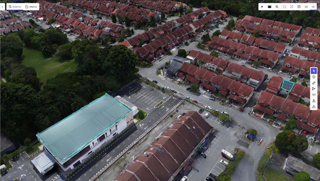
High Resolutions Aerial Mapping Solutions
High-resolution, aerial photo models provide unmatched accuracy and detail, revealing critical information that traditional methods might miss.
Mapping & Data Solutions
Coming soon
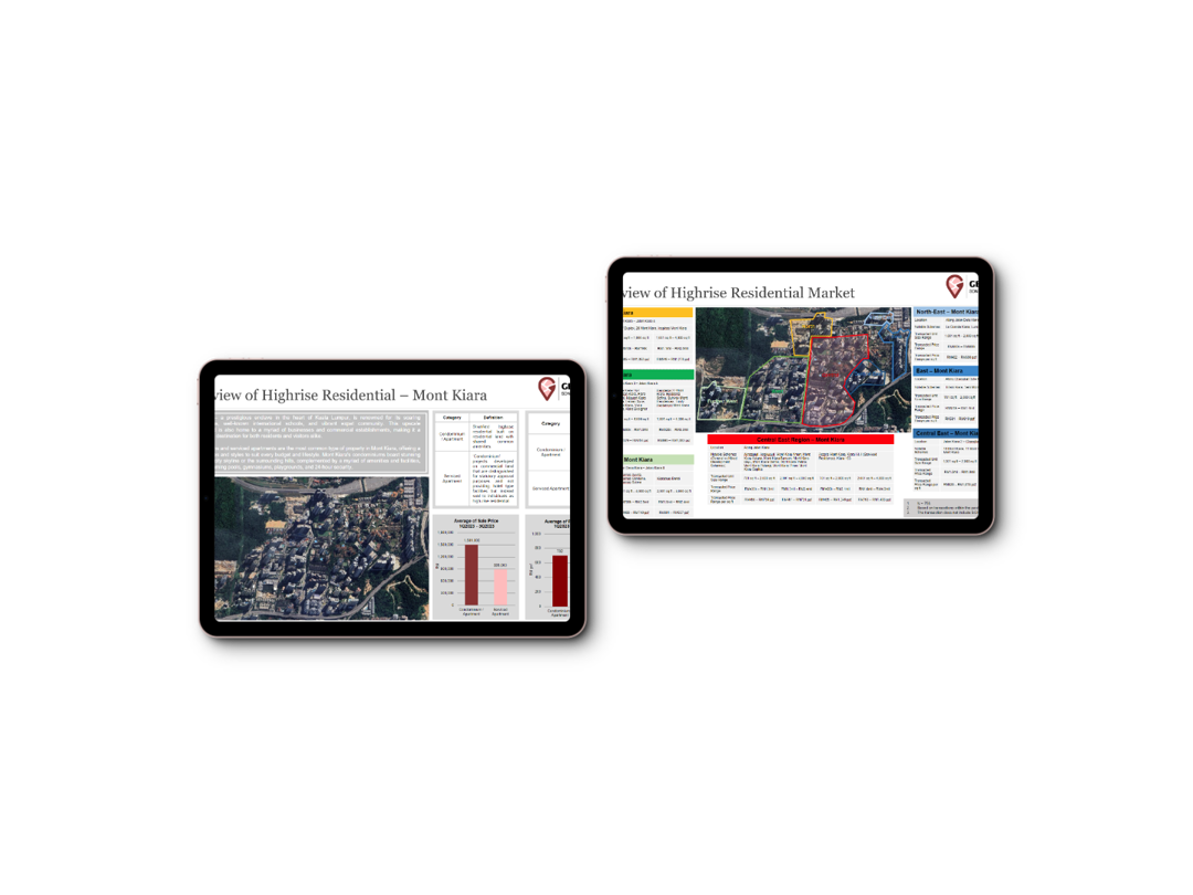
Spatial data visualisation, curated data summaries, trend analysis, and real-time updates on relevant geospatial metrics.

Customised Data Analysis & Thematic Reports
Coming soon
Spatial analysis for site selection, resource management, and market research.
Frequently Asked Questions
Insights into earth observation data and solutions.
Solutions
Oblique
Copyright © 2026 Geomapic Sdn Bhd (reg. no. 202201019490 (1465187-D)). All rights reserved.
