10 Benefits of Drones in the Real Estate Industry
Andrew Chong • 2024-04-03
Explore the transformative impact of drone photography in the real estate industry, highlighting its benefits from stunning aerial views to efficient site surveys. This article delves into how drones enhance property listings, save time and money, increase property value, and showcase unique features, making them an indispensable tool for real estate professionals.

Drone photography has become an increasingly popular tool for real estate agents, property owners and developers to showcase their properties. With the ability to capture stunning aerial views of homes and landscapes, drones have become a game-changer for real estate marketing. In this article, we'll explore the benefits of drone photography for real estate.
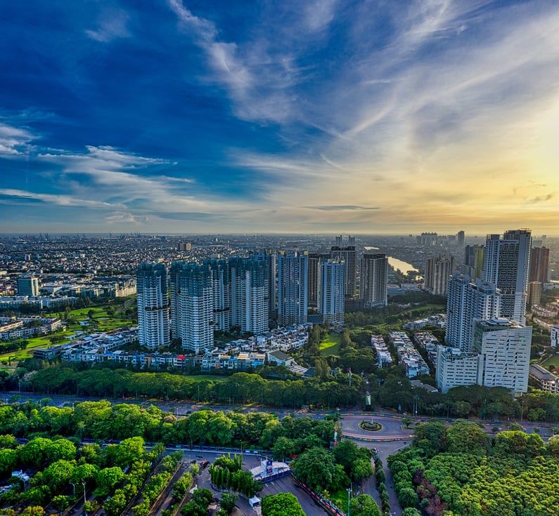
Provides Stunning Aerial Views
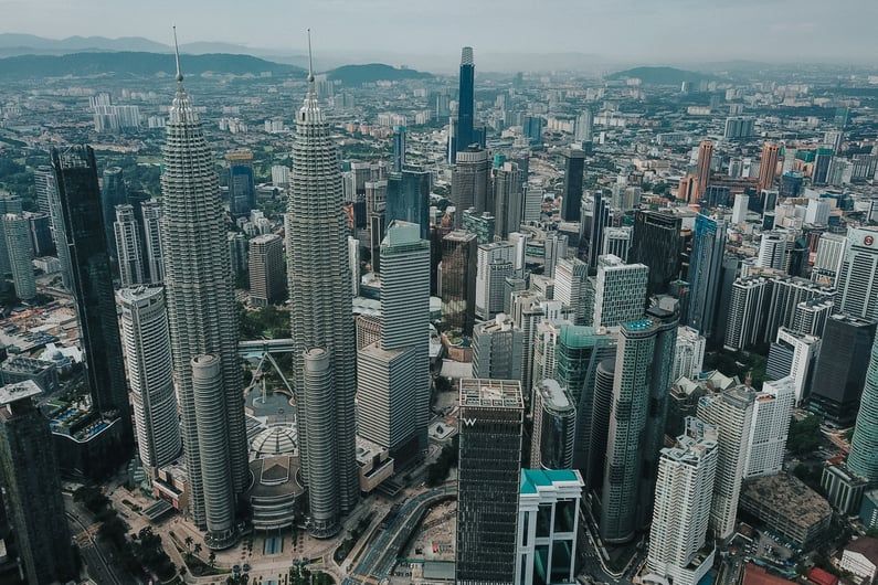
Drone photography provides a unique perspective of the property that traditional photography cannot achieve. Aerial views can capture the entire property, including the surrounding landscape, giving potential buyers a better understanding of the location and neighborhood. With drone photography, you can capture the property's size and layout and showcase features that would be difficult to capture from the ground.
Enhances Property Listings
With the use of drone photography, you can create an immersive experience for potential buyers, showcasing every aspect of the property. These images can enhance your property listings and make them stand out from the competition. A well-captured drone photo can showcase the property's beauty and attract buyers, making the property more marketable.
Saves Time and Money

Drone photography can save time and money for both real estate agents and property owners. Instead of scheduling multiple site visits and photoshoots, drone photography can capture all necessary images in one go. This not only saves time but can also save money on travel expenses and hiring photographers.
Increases Property Value

Drone photography can increase the perceived value of a property. By providing a complete view of the property, including the surrounding neighborhood and landscape, potential buyers can visualize the property's potential. Drone photography can help buyers see the property's features and amenities, making it easier for them to imagine themselves living there.
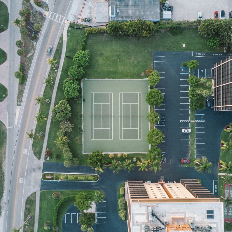
Showcases Unique Features
Drone photography can showcase unique features that would be difficult to capture otherwise. For example, if the property has a pool or a large backyard, a drone can capture an aerial view of these features. This type of photography can also capture other unique features such as gardens, decks, and rooftops.
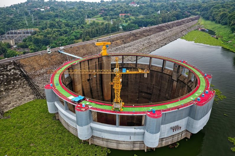
Aerial Views for Site Surveys
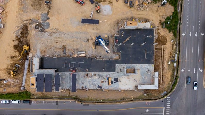
Drones can capture aerial images of a construction site, providing a bird's eye view of the area. This can help site managers and project owners to perform accurate site surveys, mapping, and measurements. Drones can also capture images of difficult-to-access areas and provide a detailed view of the site's terrain, improving site planning and design.
Improved Progress Monitoring
Drones can capture images and videos of the construction site, providing a detailed view of the project's progress. This can help site managers to monitor the construction site, identify potential issues and ensure that the project is on schedule. Drones can capture data and provide insights that are difficult to obtain from the ground, helping to keep the project on track and within budget.
Enhanced Safety and Security
Drones can capture images and videos of the construction site, providing a view of the site's safety and security. This can help site managers to identify potential hazards, ensure that workers are following safety procedures and prevent accidents. Drones can also provide a view of the site's security, identifying potential security risks and ensuring that the site is secure.
Efficient Inspection and Maintenance

Drones can capture images and videos of the construction site, providing a detailed view of the site's equipment and infrastructure. This can help site managers to identify equipment and infrastructure issues and perform preventative maintenance. Drones can also provide a view of the site's environment, identifying potential environmental risks and ensuring that the site is compliant with environmental regulations.
Improved Communication and Collaboration

Drones can capture images and videos of the construction site, providing a visual representation of the project's progress. This can help site managers and project owners to communicate the project's progress to stakeholders, investors and other parties. Drones can also provide a view of the site's progress, enabling collaboration between project teams and stakeholders.
In conclusion, drone photography has become an essential tool for real estate agents and property owners. With the ability to capture stunning aerial views, enhance property listings, save time and money, increase property value, and showcase unique features, it's no wonder that this type of photography has become so popular. If you're in the real estate industry, drone photography is a valuable tool that can help you stand out from the competition and attract potential buyers.
See More Posts


Discovering location intelligence, one layer at a time.
Solutions
Oblique
Copyright © 2024 Geomapic Sdn Bhd. All rights reserved.