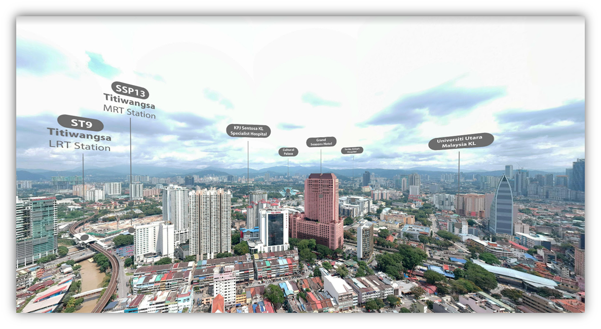
Case Studies: Drone Aerial Photography & Satellite Imagery
Andrew Chong • 2024-04-03
Explore how our innovative combination of drone aerial photography, data sourcing, and GIS mapping revolutionized the way a Real Estate Data Aggregator captures and validates development progress across Malaysia, enhancing pitches with over 1,000 detailed construction updates and HD panoramic imagery.
The Client
Real Estate Data Aggregator
The Service
- Drone Aerial Photography
- Data Sourcing & Validation
- GIS Database Streamline Mapping
Business Goals & Challenges
- To get a holistic understanding and progress updates of up coming developments across Malaysia.
- Obtain updated data & validate land use data
- Obtain HD and 360 panoramic drone shots of various areas across Malaysia
Solutions & Results
- 1,000 + construction signboard and their details were captured
- Client were able to learn the status of each project from under construction to future development and relayed that in their pitches.
- Drone 360 Panoramic services assisted the client in capturing details in the surrounding landscape that could not be spotted with a site visit
- Using the data that was sourced, the client was able to create a comprehensive mapping system with high definition imagery across multiple states.


