Geographical Information Systems and Urban Planning
Andrew Chong • 2024-04-03
Explore the vital role of GIS software in revolutionizing urban planning, from land use and transportation planning to environmental protection and emergency management. This article highlights how GIS technology empowers urban planners with the data and tools needed for informed decision-making, fostering more sustainable, efficient, and community-focused urban environments.
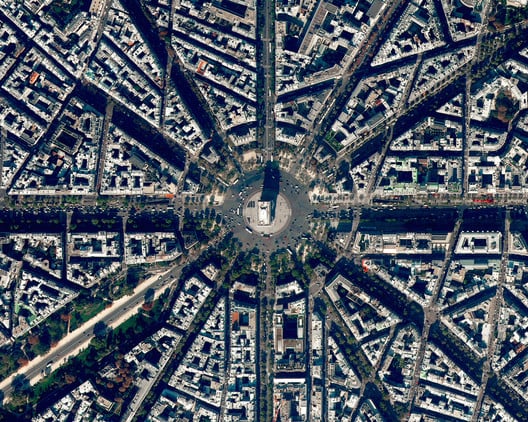
Geographic Information System (GIS) software has become an essential tool in urban planning over the past few decades. GIS software enables urban planners to visualize, analyze, and manage spatial data to make informed decisions about the built environment. In this article, we will explore the various uses of GIS software in urban planning.
What is GIS?
GIS is a computer-based system that allows users to capture, store, manipulate, analyze, and present geographically referenced data. GIS software utilizes maps, aerial photographs, satellite images, and other types of geographic data to create digital maps that can be used for planning, analysis, and decision-making.
GIS technology can be used to combine different types of information about an area, including physical features such as terrain, infrastructure, land use, demographics, and environmental characteristics. This information can be used to identify patterns and relationships between different variables, providing insights that can inform urban planning decisions.
Uses of GIS in Urban Planning
- Land Use Planning GIS technology is widely used in land use planning to identify land use patterns, predict future land use changes, and evaluate the impacts of proposed developments. With GIS, urban planners can create interactive maps that display current land use patterns, zoning regulations, and potential development sites. This information can be used to evaluate the suitability of proposed land uses and determine the impact of proposed developments on the surrounding environment and infrastructure.
2. Transportation Planning GIS is also useful in transportation planning. Transportation planners can use GIS software to create detailed maps of transportation networks, including roads, public transportation, bike lanes, and pedestrian walkways. By analyzing transportation data, planners can identify traffic patterns, bottlenecks, and areas where improvements are needed. GIS technology can also be used to model the impact of proposed transportation projects, such as new highways, on traffic flow and congestion.
3. Environmental Planning
GIS software is also valuable in environmental planning. Urban planners can use GIS technology to map and analyze environmental features such as watersheds, wetlands, and wildlife habitats. By overlaying different types of environmental data, planners can identify areas where development should be limited to protect sensitive ecological areas. GIS can also be used to model the impact of proposed developments on the environment and to identify ways to mitigate negative impacts.
4. Emergency Management GIS technology is also useful in emergency management. During natural disasters or other emergencies, GIS can be used to create maps that display the location of critical infrastructure, emergency response teams, evacuation routes, and shelters. This information can be used to coordinate emergency response efforts and to provide residents with real-time information about the emergency situation.
5. Community Engagement
GIS can also be used to facilitate community engagement in the urban planning process. With GIS, urban planners can create interactive maps that allow residents to explore proposed development plans, provide feedback, and participate in decision-making processes. This can help to build trust between planners and residents, increase transparency in the planning process, and ensure that development decisions reflect the needs and desires of the local community.
GIS technology has become an essential tool in urban planning. By providing planners with detailed spatial data and analytical tools, GIS enables them to make informed decisions about land use, transportation, environmental protection, emergency management, and community engagement. As the use of GIS software continues to expand, urban planning will become more data-driven, transparent, and responsive to the needs of local communities.
See More Posts


Discovering location intelligence, one layer at a time.
Solutions
Oblique
Copyright © 2026 Geomapic Sdn Bhd (reg. no. 202201019490 (1465187-D)). All rights reserved.